Cargando...
Recursos educativos
-
Nivel educativo
-
Competencias
-
Tipología
-
Idioma
-
Tipo de medio
-
Tipo de actividad
-
Destinatarios
-
Tipo de audiencia
-
Creador
Lo más buscado
- Múltiplos y súbmultiplos
- Juegos matemáticos sala de 5 años
- Actividades educativas para niños segundo
- Uso de g y j
- Canciones en inglés
- Tripticos de experimentos
- Área del círculo
- Thomas Edison
- Religión Católica
- Países de Asia
- Biosfera para segundo
- Inventos de máquinas
- Horas del reloj educación primaria
- canciones inglés
- Experimentos de matemáticas educación primaria
-
Halloween
Tiching explorer Organización
- 3 lo usan
- 8278 visitas
Slideshare presentation that teaches us about Halloween traditions and symbols.
-

pharaoh's symbols.pptx
teresa sanchez vivancos Docente
- 1087 visitas
LABEL THE IMAGES ANS STATE THE MEANING OF THEIR SYMBOLS
-
Song: Rain, rain, go away
Tiching explorer Organización
- 3 lo usan
- 34881 visitas
Listen to a song about the weather.
-
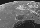
EUMETSAT satellite images
Maria Pallarés Docente
- 1 lo usan
- 7477 visitas
EUMETSAT weather satellite images from Western Europe.
-

pharaoh's symbols.pptx
teresa sanchez vivancos Docente
-
(1)
- 1 lo usan
- 2150 visitas
label the pharaoh's symbols and explain what they mean
-
-
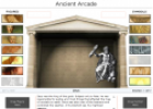
Game: Greek God arcade
Tiching explorer Organización
- 3 lo usan
- 5023 visitas
In this interactive game we match the mythological figures with their symbols.
-
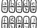
Ancient Egypt numbers and letters
Tiching explorer Organización
- 3 lo usan
- 5994 visitas
Printable worksheet (PDF file) that contains the Egyptian symbols for our alphabet letters and numbers.
-

Christmas
Tiching explorer Organización
- 5 lo usan
- 5793 visitas
Interactive resource that provides information about Christmas: origins, symbols, customs and movies.
-

April fools' day
Tiching explorer Organización
- 2 lo usan
- 6204 visitas
Slideshare presentation that teaches us about April fools' day tradtions and symbols.
-
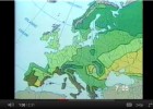
Geography Tutor - Map Skills
Tiching explorer Organización
- 1 lo usan
- 7721 visitas
Covers map directions, distances, scale, plotting latitude and longitude, common map symbols and features, and more.
Te estamos redirigiendo a la ficha del libro...


