Cargando...
Recursos educativos
-
Nivel educativo
-
Competencias
-
Tipología
-
Idioma
-
Tipo de medio
-
Tipo de actividad
-
Destinatarios
-
Tipo de audiencia
-
Creador
Lo más buscado
- Múltiplos de 8
- Juegos numéricos
- Juan Carlos Onetti
- Actividades cientificas para niños primero
- Cine para educación inicial
- Lagos de Europa
- Imprimir material
- Juegos de tablas de multiplicar
- Civilizaciones de la antigüedad
- Normas de convivencia
- Carga eléctrica para primero
- Juegos para aprender en educación secundaria
- Miguel de Cervantes
- Ejemplo de descripción literaria
- Juegos para aprender
-
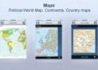
World countries
Tiching explorer Organización
- 1 lo usan
- 7647 visitas
It is an application for iPhone and iPad. It contains continental maps and flags for more than 250 countries. There are also three types of quizzes: capitals, maps and flags, and trivia and flash cards.…
-

Website: Community walk
Tiching explorer Organización
- 1 lo usan
- 5175 visitas
This website allows us create personal maps. We can include sites on a map with descriptions and images. We can use the maps to describe field trips, report on historical events, and do other mapping…
-

Spicynodes
Tiching explorer Organización
- 1 lo usan
- 2981 visitas
Online tool that allows us create mind maps and nodes. There is an individual free version (that includes their logo in our creations). We can embed the maps in our blog/site.
-
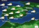
Predicting the weather: Euronews weather forecast
Maria Pallarés Docente
- 3 lo usan
- 17558 visitas
Euronews weather forecast to introduce the symbols of weather maps and analyse weather conditions. Duration: 2.35 minutes.
-

Nighttime!
Ángel Trasobares Castillo Docente
- 1 lo usan
- 3451 visitas
Mapa de la Tierra facilitado por Google Maps donde podemos ver nuestro planeta de día o de noche.
-

Connected Mind
Héctor Espinoza Hernández Docente
- 1 lo usan
- 5480 visitas
Draw unique and memorable mind maps, store them in the cloud for free and access them anywhere
-
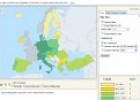
European Union’s population density
Maria Pallarés Docente
- 1 lo usan
- 6018 visitas
Website of the EU statistics office, Eurostat, which has maps on population density of EU countries (1999 to 2010).
-
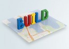
Build with Chrome
Jordi Mulet Docente
- 1 lo usan
- 3370 visitas
Now you can build with LEGO® bricks using Google Maps as your baseplate. Imagine. Explore. Build online in Chrome.
-

Economía mundial entre 1815-1870
Tiching explorer Organización
- 1 lo usan
- 8342 visitas
Mapa de Google Maps para realizar una serie de actividades sobre la economía y la Revolución industrial del siglo XIX.
-
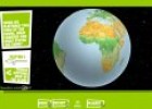
The globe unwrapped
Maria Pallarés Docente
- 1 lo usan
- 4047 visitas
Multimedia presentation in which the children can compare how the Earth’s shape is represented on globes and maps.


Te estamos redirigiendo a la ficha del libro...
